- Catchment Facts
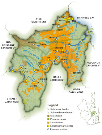 Total area: 1,195km2
 - Stream network length: 2,475km
- Local Councils: Brisbane City Council, Logan City Council, Scenic Rim Council
- Dominant land uses: urban, native bush, grazing, rural residential
- Highly modified, urbanised catchment
- Some grazing lands and natural bush/forested areas remain in the upper parts of the catchment
- Riparian vegetation has been cleared from most waterways
- Large volume of stormwater runoff into the waterways during/after storm events
- Population growth is a major pressure on the catchment
Freshwater results
F Lower Brisbane Catchment
- Streams in poor condition.
- Declines in the Nutrient Cycling, Aquatic Macroinvertebrates and Physical/Chemical indicators.
- Improvement in the Fish indicator across both seasons, slight improvement in Ecosystem Processes.
Estuarine results
D+ Brisbane Estuary
- Decreases in dissolved oxygen, turbidity and biological health rating with slightly higher sewage nitrogen signals detected.
- Lower phytoplankton abundance.
- Salinity throughout estuary lowest since 2001, indicative of high freshwater inputs.
D Cabbage Tree Estuary
- Increases in phytoplankton abundance and nitrogen concentrations at most sites.
- Continued elevated phosphorus at all sites.
- Continued low dissolved oxygen.